 |
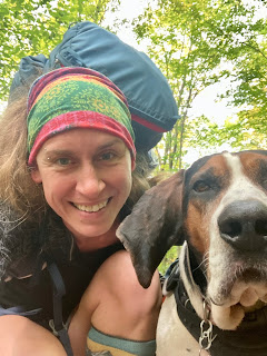
| Me and my traveling companion, Amos - our finish photo - roughly 80 miles we hiked on the Susquehannock Trail System (including the miles we did twice!) |
The autumn equinox - that precious time when we practice letting go, shedding the old so that we grow anew. It is a bittersweet time, saying goodbye to summer and hello to cooler days. The very breeze itself, cool and brisk, seems poignant. But at least Mother Nature gives us a final hurrah, a great party of color, before dipping into slumber. What better way to recognize this time than with a good long walk in one of the most beautiful places one can be this time of year - the Pennsylvania Wilds. And I also had another really good reason. My other half, Scott, is being all rockstar touring Europe with his band for an entire month. Rolling in a van for hours with three sleep-deprived men and waiting in the wings backstage for twenty-five shows wasn't my cup of tea, but it seemed a good time to journey myself.
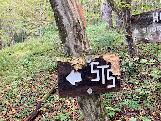 |
| Susquehannock Trail System sign |
Folks, meet the Susquehannock Trail System, or as the hep hikers call it, the STS. This 84- mile circuit trail is comprised of 63 connecting trails. These trails were first cut as Civilian Conservation Corps fire trails, others are old railbeds or forest roads, and a handful were crafted to link these together. Each trail blends seamlessly into the next and as I passed yet other side trails, not part of the circuit, I only wished I had more time to explore. The STS, located in north-central PA (Potter and Clinton counties) travels almost entirely through the Susquehannock State Forest which protects 265,000 acres and dips briefly into Sproul State Forest which shelters 305,000 acres. The Susquehannock Trail System is gloriously remote.
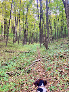 |
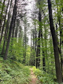
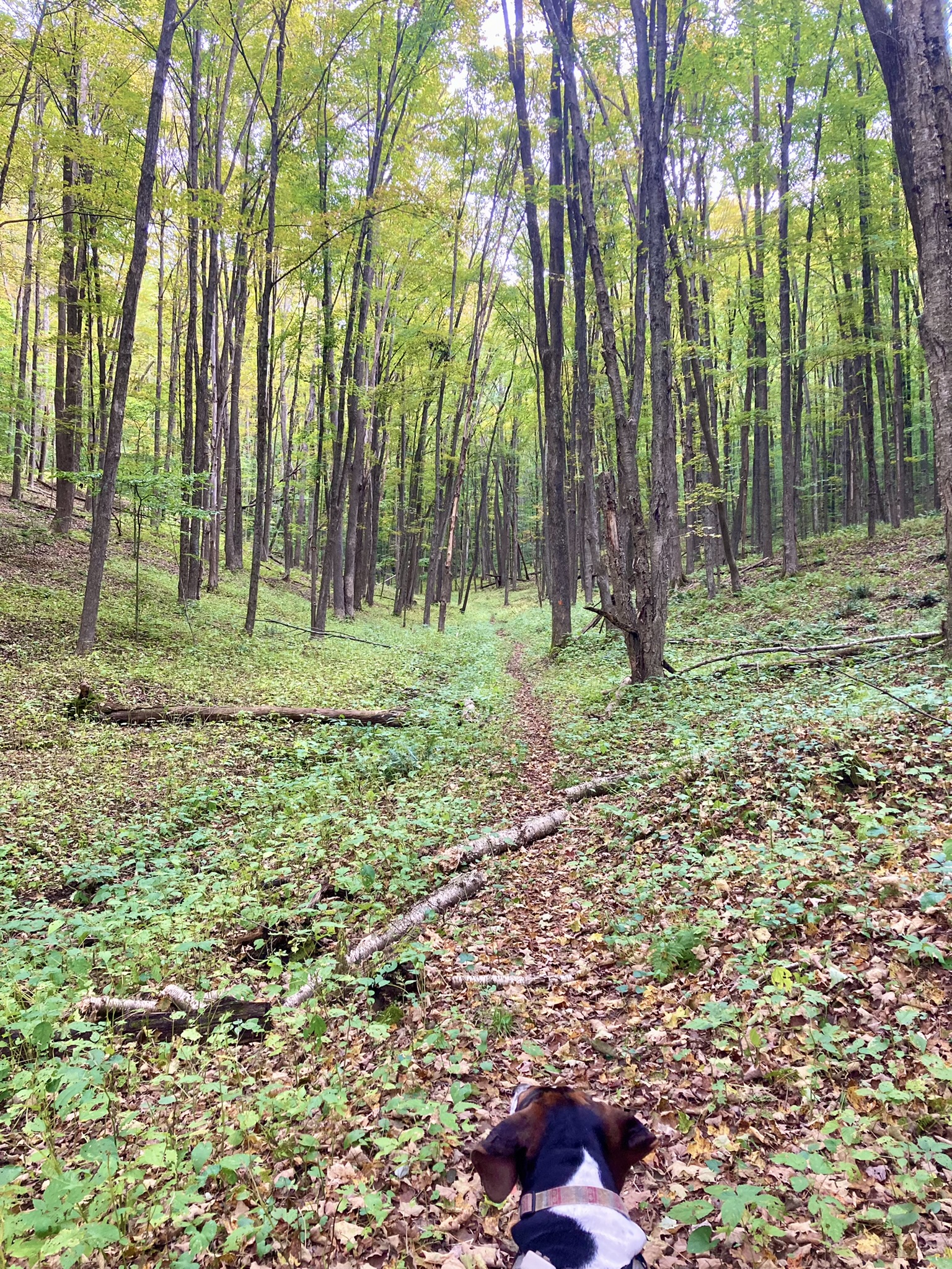
| Amos peering down trail |
This very remoteness is what enticed me. I love meeting other hikers, I love talking trail talk, but that's not why I go to the woods. Periodically, I enjoy, and require, a good dose of solitude. And Amos, well he always prefers woods to civilization. However, I did like the fact that the STS had one resupply option along its route - the quaint town of Cross Fork, population 45. I also liked the fact, given our isolation, that the Susquehannock Trail Club clearly listed shuttle assistance on their website. I have admittedly gotten awfully used to my rockstar waiting in the wings should I need assistance. I am blessed that I have my person that would drive across the state for me should I need. But Germany - that's pushing it. I'm not that much of a diva. I reached out to Wanda Shirk - long-time KTA board president and an accomplished hiker herself - who was listed as shuttle assistance for the northern portion of the trail, and she responded enthusiastically, even answering drop-box and parking questions. Although I doubted I'd need assistance, it sure was nice to know it was available. Trail angels in the wings.
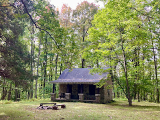 |
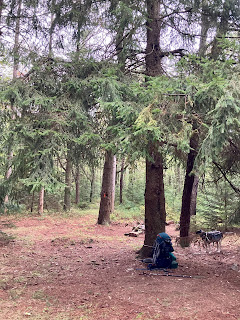
| Cherry Springs fire tower ranger's cabin |
On the autumn equinox, after a long drive west (roughly four hours) I began my hike late in the day, parking at Cherry Springs fire tower. There I waited for the rain to break, while Amos whined to get paws on trail. When finally the sun peeked through the clouds, we were off, frolicking two miles down leafy trail, where we camped at a grassy intersection with the Bolich trailhead. That evening, the resident coyotes, whom I'd later learn made a regular circuit through these parts, yipped and howled. Amos sat at attention but knew better than to make any claims to turf. In the morning, although pleased to have gotten at least a couple miles down the trail, I realized that I'd left the bulk of my cooking fuel in the car. With temps predicted to drop in the coming days, I didn't want to chance it. So, we packed up and scurried, uphill, back to Cherry Springs. There's nothing worse than doubling back on a long hike. I couldn't bear the thought of hiking those miles for a third time in less than twenty-four hours, nor would Amos oblige me. I know my pup. So, we headed for Short Run Rd, four miles ahead by trail, to park and begin again. We were well rewarded.
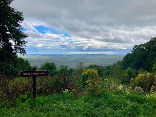 |
| A vista from the road near Cherry Springs |
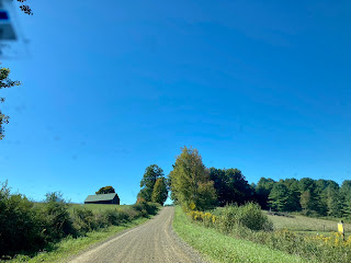 |
| Short Run Road |
Not only was Short Run Rd a journey of its own - a long winding gravel road that led us through rolling countryside dotted with cabins and farmland - but we snagged an incredible vista too. Making this small leap on the trail, I'd find in the upcoming days, would also synchronize us with trail magic and protection from fitful weather tantrums. Had we not, our journey may have been diminished.
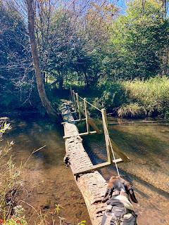 |
| Amos preparing to cross one of the many bridges on the STS - this was the typical form of bridges along this trail. He crossed these with ease, always following right behind me. |
We parked across the road from a little white cabin, "Custer's Last Stand" signed above the doorway and dipped into a tunnel of green alongside Cross Fork Creek. We crossed bridges - many fashioned from fallen trees and cable with the exception of a very impressive suspension bridge that gave Amos pause as it swayed and bounced with our weight. Birds were plentiful. We spotted our first killdeer - a bird that nests in meadows and feigns a broken wing to draw attention away from her young - and two blue herons that took flight, one east, the other west, as we startled them.
 |
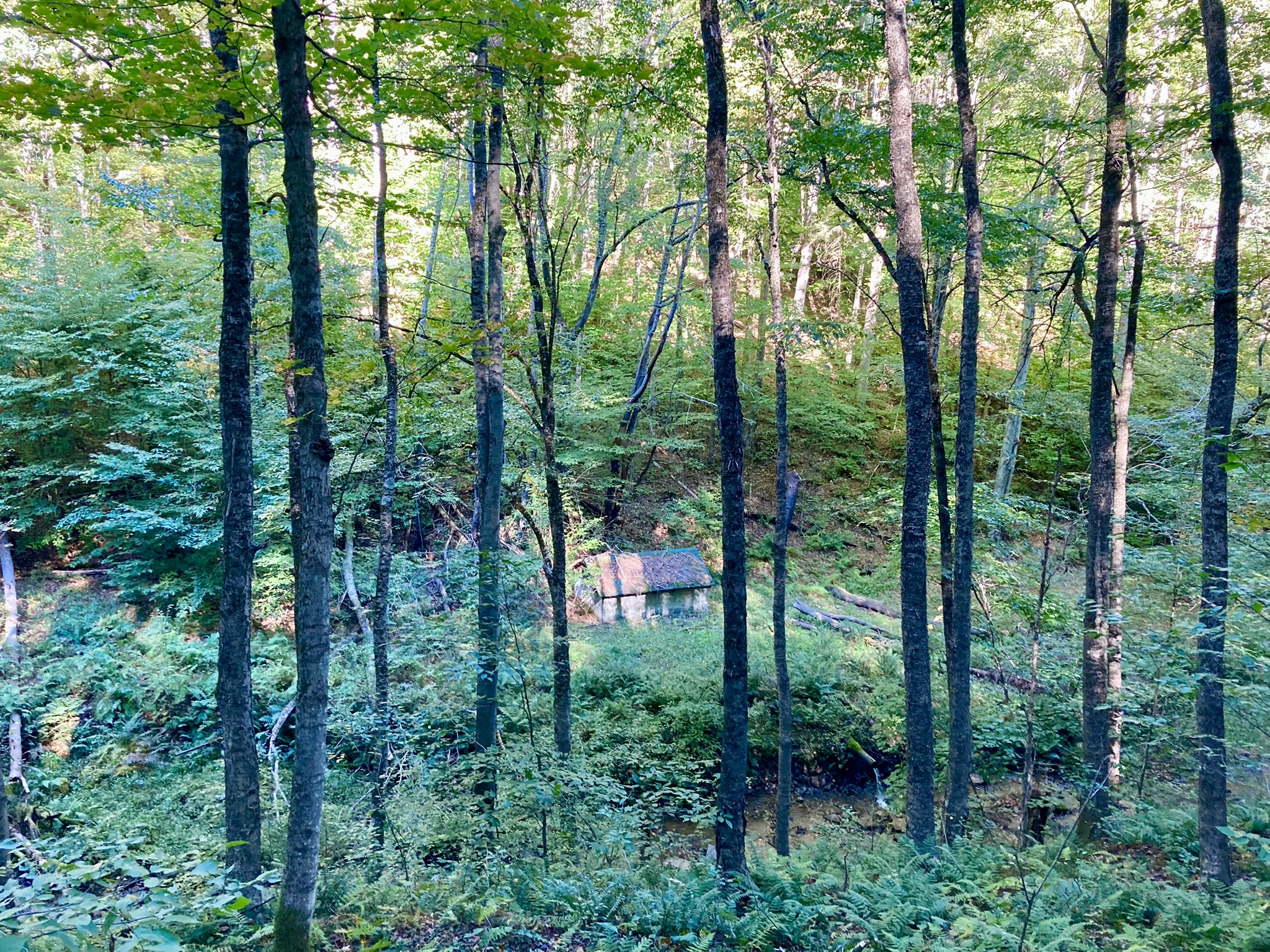
| An old springhouse at Ole Bull State Park |
Carrying on through the forest, we approached Ole Bull State Park, glimpsing remnants of the past. An old springhouse and intricately built stonewalls lay nearly hidden amidst the trees and ferns. Turns out, this land has some interesting history. In 1953, a Norwegian violinist and composer, Ole Borneman Bull, purchased this land, sight unseen. He planned to build a utopian colony along with 150 of his followers. However, when they arrived and found only steep rocky slope and ribbon-thin valleys, most headed for better farmland in the Midwest. I imagined what it must have been like trying to eke out an existence in this divinely beautiful but rugged hollow. Days later, I would relay the history of Ole Bull to my mother - of Swedish and Norwegian descent - and she'd nonchalantly reply, "Oh Ole Bull? I think we're related to him." What?? I have yet to have this confirmed, but she is digging up the family tree and conferring with relatives who, just so happen, to reside in the Midwest. My goodness, perhaps I knew this hollow better than I'd realized.
At Ole Bull campground, I retrieved a package that I'd dropped there in advance with Dave, the caretaker. Dave had been so kind to hold the package in his trailer's storage compartment and incredibly gracious in accommodating us a place to sort foodstuff. Sheepishly, I thanked him with only a canister of Pringles that I couldn't bear to carry. Thank you so very much, Dave for your kindness! To ensure Amos reprieve from the campground crowds, up the steep mountainside we went where we made camp. The breeze swept over the mountaintop and the tall trees sang most of the night. As I lay nestled with Amos in my tent, I listened close to their storied song.
 |
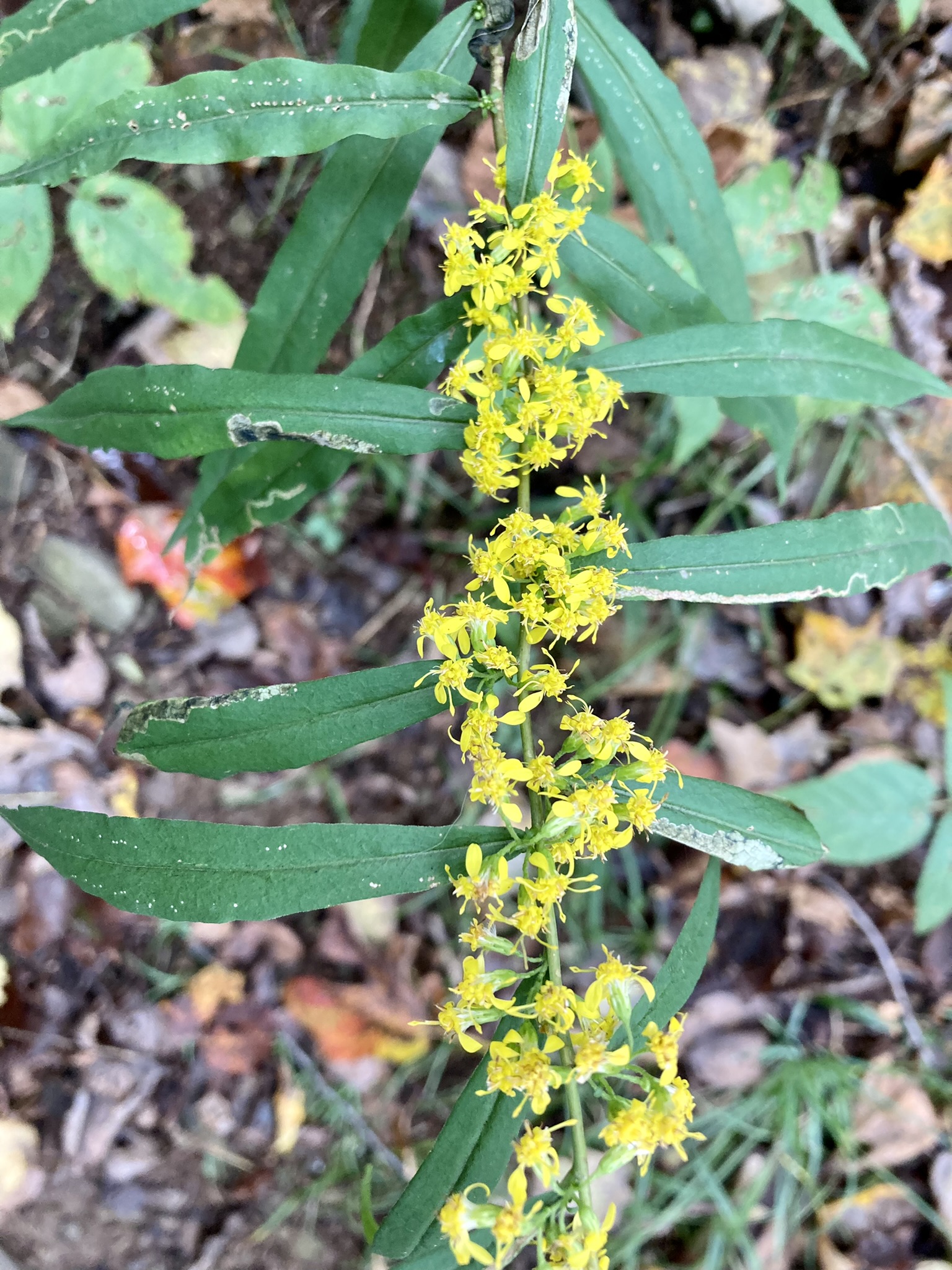
| Bluestem goldenrod (Solidago caesia), aka woodland goldenrod given the fact that it made often be found in the shade of the forest. Goldenrods in general make a delicious tea, using flowers and leaves, and are very effective at quelling seasonal allergy symptoms. One of my go-to's for the sniffles! |
 |
| Purplestem aster (Symphyotrichum puniceum) - a common companion of goldenrod and a frequent plant along the STS |
In our travels the next day, we made the acquaintance with many a botanical inhabitant. Goldenrod was in its glory as was aster and both would remain ever-present throughout the rest of our hike. Bluestem goldenrod, zigzag goldenrod, wrinkle-leaf goldenrod. Purplestem aster, calico aster, blue wood aster. We also made our acquaintance with the one and only hiker we'd cross paths with for ten days. And what timing!
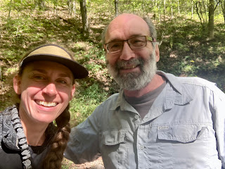 |
| Me and Bill, a fellow STS hiker who just so happened to be in the right place at the right time! |
Bill is section-hiking the trail, knocking off ten miles of trail a day. Considering he does out and back day-hikes, he will have completed it twice by the time he's finished! That's in addition to the twenty years he's been hiking these PA hills. On this day, he was headed 2.5 miles south and 2.5 miles north, therefore our paths crossed more than once. On our third run-in, I found Bill thick in a tangle of enormous blowdowns. "I don't know that your dog's going to get through this. I don't know if I'm going to get through this!" he hollered back to me. I straddled the first of the blowdowns and began coaxing Amos over a jumble of branches. He cleared them but landed with a clatter. "I'll go ahead, see how far it goes on." Bill disappeared into the thicket. I wondered at how to clear the next heap of bark and leaves. "Keeps going as far as I can see," he declared upon return. We studied the map together and considered a work-around. Bill had his car parked a couple of miles back on Twelve Mile Road. So, we backtracked, up a big ol' hill on Big Springs Rd, and while Amos and I hung about at an intersection, Bill speedily hoofed it back to his car, returning to give us a lift down to Young Women's Creek where I could resume the trail. "It never fails to amaze me how time and time again . . . the trail provides." I said to Bill. "Sure does," he replied, "countless times when we'd be portaging canoes, the right person would come along at the right time and give us a lift." Guess it doesn't matter if your trail is water or dirt. It was a joy to meet you, Bill, and may our paths cross again! Thank you!
 |
| Amos gazing down a pipeline that the STS follows |
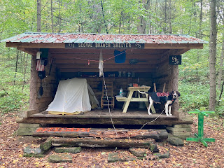 |
| Scoval Branch Shelter, which became our home for two nights. Notice the rocking chair and picnic table. Inside was also a battery-powered candle which I much appreciated, made this lean-to feel downright cozy |
That afternoon we made an arduous up-and-over along a path of stinging wood nettle and wound our way through an enchanted hemlock glen where the muddy trail was studded with deep elk tracks and piled with elk poop. I let my gaze spread out, hoping to glimpse one through evergreen boughs, but they remained elusive. That evening, we strode an undulating pipeline with sweeping autumn views and found shelter beside Scoval Branch in a lovingly decorated lean-to. There we would remain for two nights and one day as the rain pitter-pattered, and sometimes hammered, our tin roof. I communed with the stately pine in my line of sight beside the fire-ring and was thankful I'd brought a paperback.
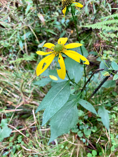 |
| Green-headed coneflower (Rudbeckia lacinata), which the Cherokee call Sochan. Its leaves make a delicious cooked wild green, however it should only be harvested in places where the plant is in abundance. |
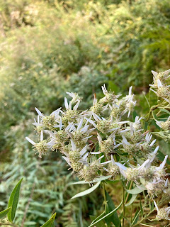 |
| Parasol whitetop (Doellingeria umbellata) - an entirely new plant for me. |
We made an attempt to leave the lean-to early in the morning, only to get dumped on within one mile. Amos doesn't do rain, not if he can help it, and he remembered where we'd been warm and dry. And so, a mad dash back to the lean-to we made! Yet more doubling-back. We sat it out until noon, while the skies dumped yet more rain. But once we got moving . . . oh the wet valley! It was gorgeous. And the plants! Green-headed coneflower (Cherokee name - sochan), parasol whitetop, and the colorful fragrant seed bodies of cucumber magnolia, which we followed into the town of Cross Fork.
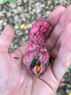 |
| The fruiting body of the cucumber magnolia tree (Magnolia acuminata) - this is a tree I had met down south in North Carolina. It is native and not unusual to find in this region, but I have not come across it in northeast PA. The red drupes (one-seed fruits) smell similar to those of spicebush and the twigs of sassafras. |
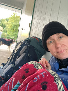 |
| Amos and I waiting out the rain in a DCNR breezeway in Cross Fork |
In town, we found two kindly DCNR workers that showed us to a breezeway where the public restrooms were and pointed out where we could camp for the night on state land on the edge of town. I retrieved yet another food-drop from Deb's Restaurant and a pile of warm cheesy fries with ranch dressing. We retreated to our breezeway for several hours while the skies let loose again. At this point I began to wonder - while eating cheese fries off the concrete and wrapped in my dog's blanket - if I was getting too old for this. But . . . the trail proved otherwise. First, with a double rainbow after the storms and secondly, with an elk sighting near to where we camped for the evening. Bugles emanated from the nearby meadow as we settled into camp and awakened us in the morning.
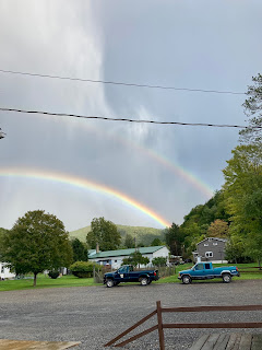 |
| Rainbows over Cross Fork |
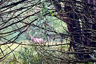 |
| Bull elk - this fella was courting his ladies who shared the same meadow. He bugled dusk and dawn. |
After a steep climb out of town, that which leaving town always seem to require, we entered the Hammersley Wild Area, comprised of over 32,000 acres, through which the trail winds for ten wild and rugged miles. This swath of land is the largest in the state without a road crossing. The route led us first through a mossy hemlock glen where saturated creek embankments and muddy trail sometimes gave way underfoot and wound us up and down, side-hilling along Hammersley Fork Creek. And although side-hilling in wet sneakers usually translates to blisters and misery, when we followed the creek into a narrow valley, we'd found the hidden treasure.
 |
| Stinging nettle (Urtica diocia) - the benefits of this plant are many! The leaves may be cooked and enjoyed as a delicious and nutritious green, steeped in hot water for a tea, or prepared as a tincture. Medicinally it is an effective anti-inflammatory, antihistamine, and diuretic. Another one of my go-to's for seasonal allergies |
Here plump green willow shrubs lined the creek, periodically punctuated by the dark bark of a stately maple topped with golden leaves. The guidebook suggested that during the height of the logging era, this valley had once hosted several railyards and even a small town. Although, I found no structural remains, the plants were a giveaway. I spied ironwood trees veiled in grape vines gone wild and European stinging nettle reached for my calves. These were once common cultivated plants, and left to their own devices, will naturalize. Amidst these periodic non-native plants, a very special native plant also resided here. Bottle gentian. I have met gentian in the mountains of North Carolina and also in the Rockies, but this is the very first I have ever found it in Pennsylvania.
 |
| Bottle gentian (Gentiana clausa) - the first I have seen in PA. Gentian is a potent bitter herb, beneficial for stimulating the digestive process. However, it should only be harvested where it is in abundance - not from the STS! |
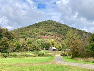
Thanks to Gravel Lick lean-to and good timing, we remained dry, arriving for the night just before the wind started to blow and the temperatures dropped, which I have learned in this region always means rain. And the following day, good lord! We were graced. After a steep descent we strode down an old railroad grade - a wide, level, leafy trail - that carried us for roughly two miles beside the Sinnemahoing Creek. Beyond the creek were vast meadows dotted with modest homes and barns and beyond those, great round-top mountains dabbed with autumn. The sun shone and blue swept across the sky. At times I walked with arms outstretched and face skyward, feeling only gratitude for the beauty and ease.
 |
| Our glorious stroll along the old railbed |
The path eventually carried us onto a country lane where we crossed the creek on a rickety ol' wooden bridge and strode right on up to one of those barns. Near to the road, a sign read: Elk under the Milky Way. I had the feeling this land not only provided sanctuary to me on this day but to these landowners daily. A slender man, old as time, drove by on a tractor, a cap snug on his head and a long cigarette hanging from his mouth. I gave a wave and he smiled with a nod. It was a treat to cross paths with someone, even if no words were spoken, who surely knew this land very well.
 |
| Walking a country lane |
That afternoon we climbed up that mighty round-top mountain, appreciated the remnants of a grassy quarry road, ducked and hopped many a blowdown - Amos is a show dog when it comes to these - and when the skies threatened rains again, jogged through beech woods. For again a lean-to was not far away. We took refuge in Wild Boy Shelter for two hours, waiting out the storm, and then by the day's dying light, hoofed it to a knoll above Prouty Lick Road. There, we lucked out with a flat spot in the woods to pitch the tent and a sunset.
 |
| Amos enjoying the sunset at our camp above Prouty Lick Road |
Our second to last day was surely the most beautiful. We stood, two roads diverged in a wood. One road would lead us further north around the circuit. The other, the West Branch Trail would, in 6 miles, lead us back to Cherry Springs fire tower. And we - we took the one less traveled by. And that made all the difference. As much as I would have loved to have traveled the entire STS circuit, I'd cut it too close with work commitments, and after all, this had been our plan all along. I had purposely plotted very low mileage on this hike. I'd had no desire to complete the trail speedily but rather experience the trail slowly. To be in it rather than seeking its end.
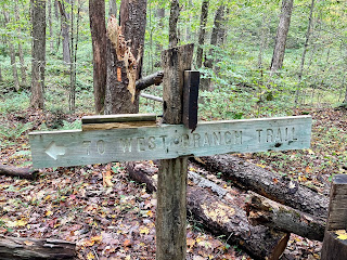 |
| West Branch Trail sign at fork in trail |
The West Branch Trail was stunning. I'd drive four hours west just to hike this unassuming connector trail again. And as is the nature of most lesser-traveled trails, it was not without its rough spots. We padded down a leafy wooded trail, but were soon swallowed in armpit-high goldenrod and blackberry bramble, briefly spit out on an ATV trail, only to be swallowed again. With the help of my GPS, I navigated sodden thickets and finally emerged into a pristine hemlock glen where the trail carried us high and dry above the creek below. We had lunch here while the sun dissolved the clouds. Then, by trail, we were transported.
 |
| The valley along West Branch Trail |
 |
| Another view of the valley |
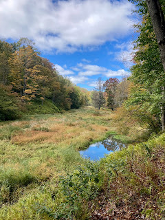
From dark woods to sunny meadow, we walked the edge of an embankment above an exquisite valley. Through this valley flowed the West Brach of Pine Creek, which had been dammed by the resident beavers along its length. These dams created enormous pools and splintered the creek into ribbon-like waterways. Tall maples with golden leaves rose from the flat grassy strip of meadow and marsh, tufts of willows persisted nearest to the water, and deep green, eastern hemlock with elegant upsweeping boughs, flanked the largest pools. To the left of my path the mountainside, thick with beech trees, rose sharply, and across the valley a mirror image of embankment and steep slope.
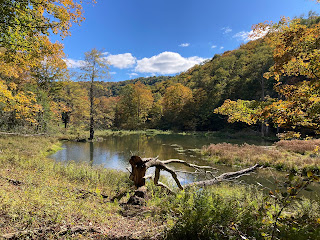 |
| One of the many beaver ponds along the West Branch Trail |
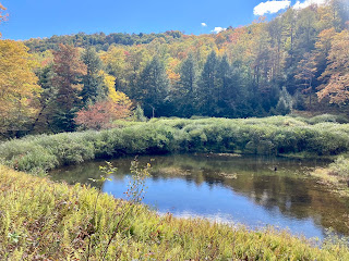 |
| Yet another beaver pond, flanked with healthy eastern hemlock |
The first mile of this splendor was arduous. Blowdowns with great leafy canopies lay like pick-up sticks across the trail. These obstacles forced Amos and I either steeply up the wooded mountain or down the slippery slope into the marsh to detour. With a big ol' pack and an eighty-pound dog attached to your waist that's trying his darnedest to figure your next move, this was no easy task. But after the first handful, he had the routine down and although I was at times clawing my way upward, dangling from skinny-trunked beech trees to steady, and crawling on hands and knees through grass and fern, it was worth every step. These obstacles lessened as we headed eastward, and I was glad we had persisted as I had wondered if we'd have to double-back yet once more and choose a different
adventure. And as we turned away from the valley into the woods, I was left picking leaves from my hair, bark from my bosom, and surprised to see smears of blood across the backs of my hands from all the blackberry prickers. We'd been through a beautiful battle.
 |
| Our camp near to the eastern end of the West Branch Trail |
We were rewarded with a tranquil campsite beside that very same creek along a grassy forest road. That night the temps dipped to thirty-three and Amos and I snuggled close for body heat. He gets wrapped in my North Face puffy along with a fleece blanket on such evenings. We took a leisurely morning waiting for the earth to warm and then began our last climb.
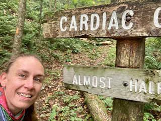 |
| Cardiac Climb - this sign reads Almost Halfway, the trail maintainers have a real sense of humor out here! |
Any climb called Cardiac Climb is bound to warm you up and that it did! By the time we reached the top (which honestly wasn't any worse than several of the other steep climbs on the STS) I'd tucked away the smartwool top and long pants, appreciating the freedom of movement in a tank top and shorts, a rare outfit with these cool, wet days. Through fern-filled woods we strode across the plateau and arrived back at the Cherry Springs fire tower in a jiffy. Amos was elated. He knew this place and I, too, found it mighty special to have come full circle! We zipped down familiar trail, past our first campsite, and then walked simply dreamy trail.
 |
| Our last miles on the STS, walking amidst the towering white pine |
Our path was an old forest road heavily wooded on both sides and carpeted in grass. At times we swept down well-mowed path through stands of goldenrod and at others I admired the changing forests, how the beech-oak-maple-cherry welcomed the addition of plentiful black and yellow birch, and when our grass turned to a cushiony path of red needles, magnificent white pine towered overhead. We descended through these pines into the heart of the forest and heard the banging of hammers and murmur of voices through the trees.
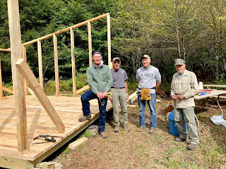 |
| Bill, Doug, Matt, and Mark - STS volunteers building the Bolich Run lean-to |
Meet Bill, Doug, Matt, and Mark, volunteers working to build the STS's latest accommodations, the Bolich Run lean-to. In fact, I imagine by now, it is finished, perhaps already decorated with an Adirondack chair and battery-operated candle. I thanked these men for their dedication and labor and was certain to tell them how many times the lean-to's along this trail came to our rescue! If you pay a visit to the Susquehannock Trail, remember that this trail is maintained and protected entirely by volunteers. Without these folks we'd have no trail at all. So be sure to say thank you! Also, say thank you when you forget your hiking sticks at the new Bolich Run shelter and one of the guys runs them up the hill to you!
 |
| With Barney Custer of "Custer's Last Stand" |
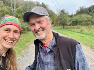
And with that, we had 1.5 miles left to go. Our trail continued to be easy-breezy and once Short Run Road came into view, I hollered, "We're here! We're here, Amos!" while running for the car. I began to slow and Amos . . . well he just kept on running. He thought we should keep on going. We had a bit of tug and pull, getting him away from the STS and back to the car. I got him in the car and he hopped out. Near the tail end of these shenanigans, I had the pleasure of making acquaintance with Barney Custer - owner of "Custer's Last Stand" across the street. "I saw your car, been parked here a long while," he said. "I hope that was all right, parking across the street here," I replied. "Oh! No trouble at all. You must've done some miles!" he answered with a grin. We got to chatting about his lovely ol' farmhouse that had been built at the turn of the century and the meadows that surround it and the nearby Frazier Farm. This property had been his grandfather's. We chatted about Amos. "Where's your next adventure?" he asked. What I told him . . . you'll have to wait and see! It was a treat to have someone greet me at the end of the trail full of interest and enthusiasm for where we'd been and what we'd seen. Thank you, Barney.
 |
| Amos following the orange blazes of the STS |
And that's just one kind of magic that appears while long-distance hiking. The Susquehannock Trail might have been a shorter trek for me (relatively speaking) but even in the nine days we were out, it fulfilled much of what I seek in a long-distance trail experience. I seek an opportunity to deepen my understanding of the plants and the ecosystem through which I travel. I seek beauty, whether subtle or magnificent. I seek solitude, not only time spent alone but time spent free of social media, google, and my phone - I'd like to share that I, by choice, did not go online for the entire journey and likely had not experienced such tech purity since my first long hike on the Appalachian Trail fifteen years ago. The fact that there was little service made this easier. I seek the exaltation that comes with physical movement and deep breath. But I have, over time, also discovered that I seek surrender. I am a planner by nature. Every long hike has an itinerary, a plan. But once on trail, inevitably, that plan goes out the window. I surrender to the unknown and always I am carried. Kind folk. Serendipitous circumstances - like a lean-to in a thunderstorm. The trust and companionship of a dog. Awe-inspiring beauty. The trail itself. The ways in which I am carried are numerous. But without request and for no reason, I am. The trail provides.
 |
| Camp on the Mid State Trail at the old Rausch fire tower site |
And so, we headed east, destination Milford. But not without one final stop. We did have one more night after all. So Amos and I pulled off near Jersey Shore, Pa and followed the long winding gravel road up to Kalbfleisch Road. Here we parked and upon my opening the door, Amos leaped from the car. Apparently, he wasn't ready to be finished either. "One more night, boy," I said. I hoisted my pack, buckled his, and we took off the done the road, my heart and mind buoyed by wonder.
Thank you to Wanda Shirk, Kristin Joivell for your STS insight and assistance, Deb and Dave for holding my absurd amount of food, the kind folks who made my hike a little brighter along the way, and to the STS trail community that makes this trail possible!
We look forward to our return to the Susquehannock Trail to hike the northernmost portion and revisit some of our favorite sections!
 |
| Amos and I dreaming of our next adventure on the Susquehannock Trail System |


No comments:
Post a Comment